From our offices in Macclesfield and Romiley, ScanTech International provides an engineering site survey consultancy providing accurate as-built data within the built environment and across a wide spectrum of market sectors including Nuclear, Energy, Process, Water, Buildings and Transport. Our culture is to listen and understand the needs of our customers and the end users of the data and to jointly develop a solution that is appropriate to the needs of the project
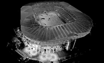
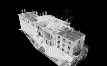
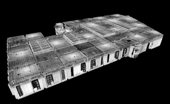
Read More3D Laser Scanning is a non-contact, non-destructive technology that digitally captures the shape and dimensions of physical structures and objects using a line of sight laser light.
Read More
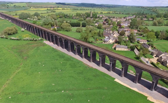
“We would like to thank you for your efforts delivering the topographic survey and 3D pointcloud survey for the 82 span, 1200m long Harringworth Viaduct recently.To complete the works for such a structure in the limited time available in the possessions was fantastic. We also appreciate your flexibility in rescheduling the works at short notice due to problems with the possession booking.We are now creating the elevations and sections for the viaduct and would like to thank you for the quality of your deliverables and your availability for ongoing discussions with our CAD team”.

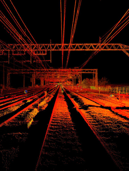
“Morgan Sindall Professional Services were appointed by London Underground to provide a multi discipline design service for the upgrade of the ventilation system as part of the Victoria Line cooling the tube programme. The ventilation shafts are only available during a series of 4 hour engineering hour slots which requires 28 days notice before access is granted. The quality of the panoramic images provided by Scantech International Ltd allow the Client, Design Engineers and Contractor to constantly view and reference the complete infrastructure with out the need for repeat site visits, saving considerable time and money and maintaining confidence as the design develops and evolves “